Tuesday 23 September 2014

Stubai: Tuesday 2nd September: rest day

Yesterday: Lauterer See and Bremer to Nurnberger
Tomorrow: Wilder Freiger to the Muller Hutte

I'm the sole occupant of my eaves dorm - the weather doesn't make for a full house. I'm not awakened by shafts of sunlight puring in through the skylight, but this is no surprise. What to do with the day? My groaning body as well as the weather argues for a rest day. Apart from my thighs feeling strained, my left ankle bone rubbing against the boot is painful.

The reason for not having a rest day is: what will I do? Won't I be terribly bored? But I decide to turn that into a positive: having not really had a rest day for further back than I can remember, it will be good to see what happens.

Spend the morning reading Herodotus - Kindle is borked. Text M so she can google the reset. This was my lunch, nominally only an appetiser but I barely finished it:

DSC_4214

4 pm: coffee and cake.

5:  Walk down path a ways from the hut for some fresh air and to get the phone some network. Ankle still hurts. text from M: hold down the power switch for *20* seconds: aha, that works.

6: Dinner: salad from buffet and BergSteigerEssen (spag bol; OK-unexciting-but-filling, which is what BSE is supposed to be). GastStaube full. Quick shower,because they're free.

Lay out kit for tomorrow, with the idea of being able to get up, b'fast and off with least delay. Set alarm for 6. Plan is to take a small selection and go up to the Muller hutte or some such over the Wilder Freiger, and have a shot at the Zuckerhutl, which I've wanted to do for ages, and now is the perfect chance - I have plenty of time before needing to meet up with M. this assumes conditions are plausible, which seems doubtful, but we'll see.

I don't have any other pix from this day. So here's some bog-cotton-grass from near the hutte from later on:

DSC_4323

DSC_4960

Monday 22 September 2014

Stubai: Monday 1st September: Lauterer See and Bremer to Nurnberger

Yesterday: Habicht and Innsbrucker to Bremer
Tomorrow: rest day.

Overnight I'm in dorm #8 with some mixed US / UK types; its about a 5-person room. Sleep well. Awake about 7 to cries of "Its snowed!" Whilst I can admire their youthful enthusiasm I cannot share it; instead I quietly groan "Oh, great" to myself and sleep in for a bit. That, and the total cloud, precludes anything exciting for the day. I'd half-planned the xfer to the Nurnberger via the Aperer Feuerstein but I think that needs to be revised now (but see Saturday the 6th).

Last night I'd talked to some English-type folks who had done the "klettersteig" from the lake and they said it was easy. So I rather regretted not taking it, and wanted to go have a look so I'd know for the future; a perfect project for a cloudy morning. After a leisurely breakfast I toddled over; its 1 km and takes about half an hour or so each way. GPS track.

Here's a view from the lake back towards the hutte (notice how I'm inconsistent there? I use "hutte", but "lake" instead of "lac" or "see". Well, never mind):
  DSC_4168

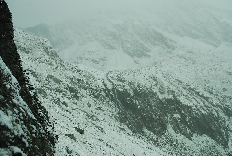
You see the path wending across the slope and heading towards what looks like a rather unpleasant rock band. But in fact its fine; that's where the "klettersteig" is, of course.

Also, since I'm being self-indulgent, here's towards the lake:
  DSC_4155

As I'm sure you've noticed it was a fairly grey day. Here's my best shot at making the "difficult chimney" look as exciting as possible:

DSC_4175

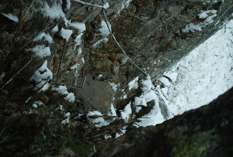
Since it really was a fairly narrow chimney its quite hard to photograph; 
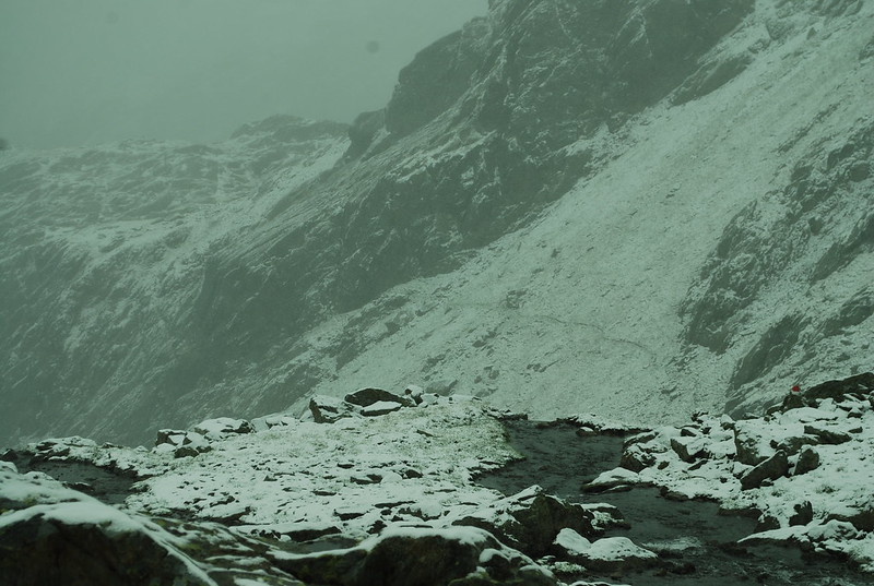
here is a view looking up, from the start. As you can see, there's piles of ironmongery and you can see that with even more snow, it might be hard to climb or descend.

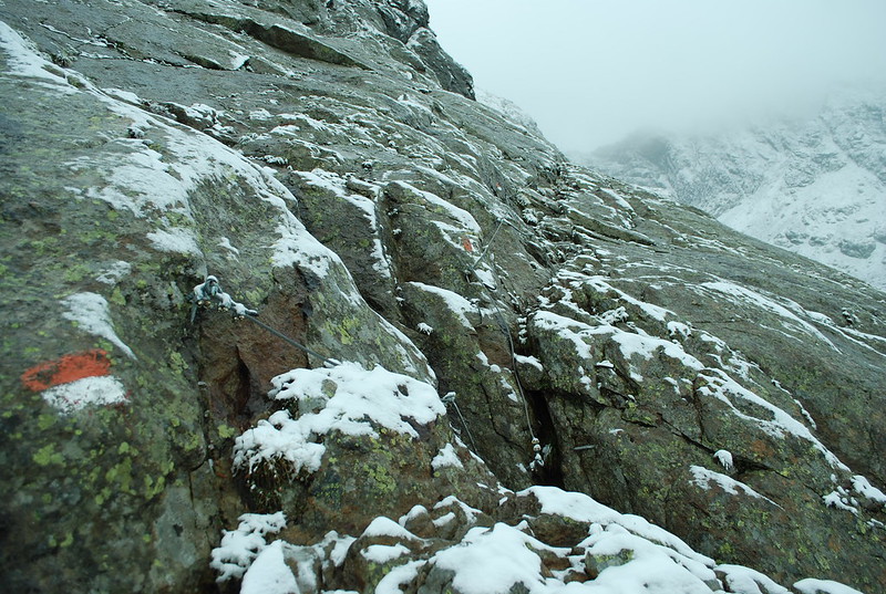
In fact, that's not the only tricky bit, there's also the "difficult slab". As you see from the below, its not all that difficult, or rather it wouldn't be in good conditions. But in the wet its smooth and slippy, and with a bit more snow (and last year there was lots and lots more snow) you'd have trouble finding the cables. And about 5-10 m to the right is a sharp drop-off, as show in the very top pic.

DSC_4176

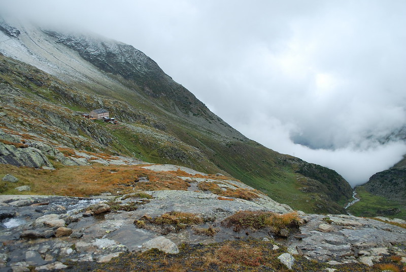
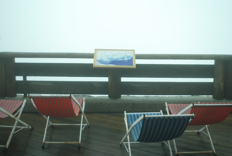
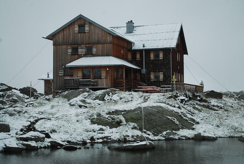
By 10:40 I'm back in the hutte, and I'm the only guest; everyone else has gone down (various people at breakfast had been talking about going over to the Nurnberger, which was what they actually wanted to do, but one by one they'd talked themselves out of it). The Guardienne looks rather dubious when I tell her I'm going across. I promise myself that I'll turn back if it looks iffy. But, not to build the tension too much, it all turns out to be fine. Before I leave, here's the Bremer in the snow:

DSC_4178

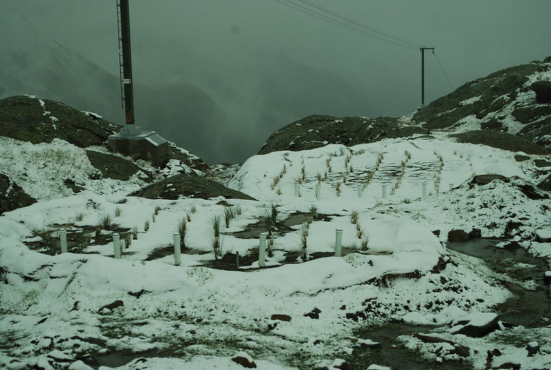
And for those interested in ecology-in-action-in-the-mountains, here's a pic of the water waste processing reed beds at the hutte. Last year, while we'd been there, we'd watched with great interest while workmen drilled and then dynamited out some rock near the hutte, in preparation for this. Clearly the reeds haven't had time to grow properly yet.

DSC_4183

The crossing to the Nurnberger is 6.4 km, took me 3:55, 500 m up and 600 m down, and I start just before 12. 2 hours to the Joch at 2754. 
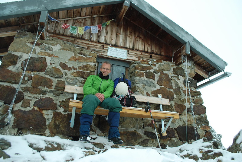
GPS track. Going up to the pass I met a man coming down, and felt faintly disappointed not to be pioneering on the day. But having a fair guarantee that it was passable, and tracks in the snow, was helpful. On the other side I met a few others. Here's me at the Zollhutte at the pass:

DSC_4188

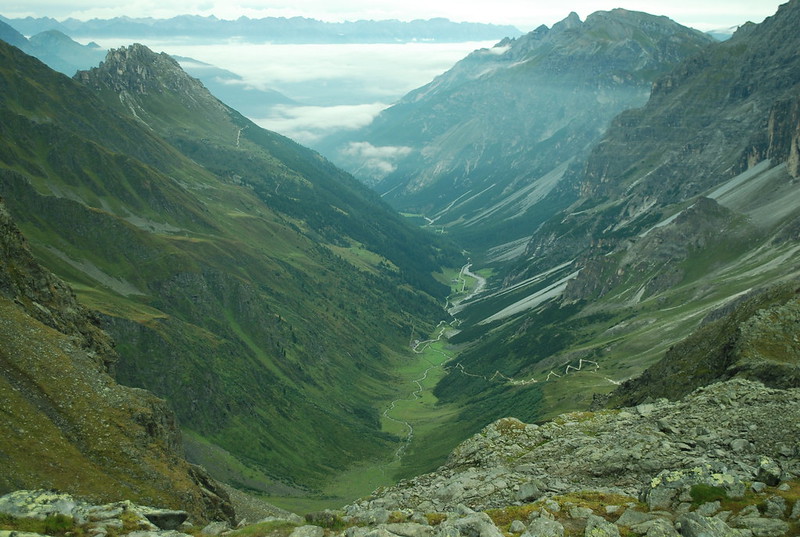
Climbing up to the Joch was hot work, so I'm sitting around up there until I got chilly again. After that its down the rocks and the short-cut snow slope quite rapidly to the "Paradise" (view down from the col; view back up towards the col. Perhaps slightly more usefully, 
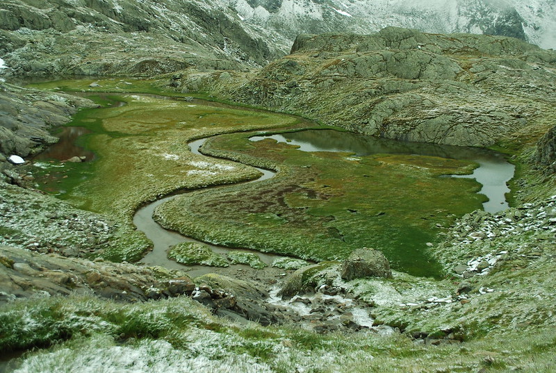
view from Nurnberger taken on the 3rd when the cloud was clear; you can just see the Zollhutte on the ridge line). The Paradies is lovely even in the snow, the sinuous line of the river is alluring:

DSC_4196

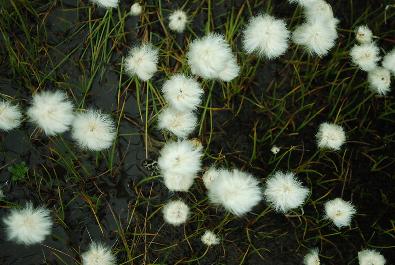
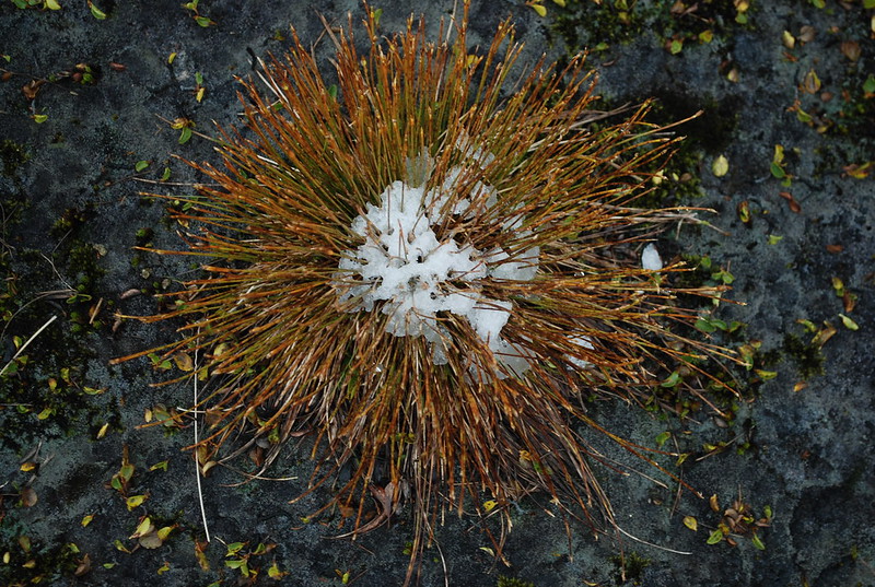
Snow effects on the plants were fun:

DSC_4208

But it was nice to get to the Nurnberger:

DSC_4210

Saturday 20 September 2014

Stubai: Habicht and Innsbrucker to Bremer: Sunday 31st August

Yesterday: Arrival: Saturday 30th August
Tomorrow: Lauterer See and Bremer to Nurnberger

I covered the Habicht on the real blog, so I won't re-do that here. Having returned to the Innsbrucker I was moderately tired:
  DSC_4147

Although that photo is just a touch posed: its how I felt, certainly, but I'm actually awake enough to be holding the camera and pressing the button and carefully arranging the picture. Here are the diary entries:

DSC_4894

and
  DSC_4896

There aren't any pics of the hut xfer, because it was like this:
   DSC_4150

Perhaps not the entire way, but for quite a lot of it. By 13:30 I'd had a kleines bier, followed by a hauswurst and a kaffee, the rain had eased to "gentle", and I'd decided that I'd go for it. The book time is 6-7 hours, obviously I could do better than that, and I hadn't really got it into my head yet that its September not July, the sun does set by 8 and its pretty well dark by 8:30. It had happened yesterday, of course, but somehow I pushed that away.

Anyway: no, I couldn't do it in less than book time. In the end, what with wandering lost in the dark, being tired from the morning's Habicht, and carrying a heavier-than-I-really-ought-to-have sac, it took me 7:20. Sometimes it didn't rain. Here's the GPS track for the bit before it ran out of battery. The GPS track runs out at "the signpost" where you get a choice of the "normal" path to the hut (which descends about 200 m, crosses the river, and then climbs again; see the start of the GPS trace from 2013 for details) and the "klettersteig" route (which traverses to the Lautersee, then traverses to the hutte, but after the See there's a "klettersteig" section. Now I hadn't given much thought to this - Miriam and I, coming the other way, hadn't done the klettersteig last year because it was too snowy, so I didn't know what it was like - but at 19;45 in the gathering dark I decided to be "good", heed the warnings - "nur fur " - and choose the "safe-n-sure-if-longer" normal route.

This was a mistake, for two reasons: firstly and known only in retrospect, the klettersteig is easy. Secondly and really-I-ought-to-have-remembered-in-advance the "normal" route isn't easy - its not ata ll like the valley path up to the Innsbrucker, it wends its way up through a rock band and is quite hard to find - even with frequent paint-markings - in the dark, by the light of a head torch, with rain spattering my glasses.

At the river I lost the path for a bit - this is easy to do, because you have to rock-hop over a wideish river. In the daylight, this would have been no problem. After casting around for 10 mins and refinding the path I found myself threading up through steepening slopes, sometimes rungs let into the rock (at least I knew I was on track) and seriously wondering if I would have to bivvy for the night. Which wouldn't have been fun as by next morning, there was snow. Happily, fear gave me strength and the bit I was somewhat dreading - regaining the 200 m I'd lost in descent to the river - was no problem at all. In the end, I saw the distant lights of the hutte outlining the cargo-lift pylons and stumbled in over their newly planted reed beds and was safe and comfy and warm and dry.

Oh, and I don't seem to have said much about the scenic quality of the path. It wasn't really a great day for scenic quality, as I said, and I spent time either hurrying on or feeling tired. The end result - after a few days when my mind had settled down - was a feeling of great triumph.

Stubai: Arrival: Saturday 30th August

Elsewhere: Stubai 2012 / Greece August 2014.

Previous: Packing List
Tomorrow: Stubai: Habicht and Innsbrucker to Bremer: Sunday 31st August

We begin with my reward at the end of the day. Now read on...


DSC_4104

After completing the packing list I went to bed late on Friday night, in preparation for the morrow. The details (probably only readable by me) are in the Red Moleskine diary.
  DSC_4897

DSC_4894

For a flight at 14:45 from Gatwick I needed to get up at 6:30 in order to avoid hassle and rush; but since this gave me coffee-drinking unpressured time at the airport and on the trains, this was fine. Somewhat unfortunately the flight was delayed (luggage, and then take-off slot loss) by about 1:30, and I missed a bus at Innsbruck station by less than a minute (there's another lesson to learn there, which is that the Airport bus and the Neustift bus actually cross somewhere around about the Arch. So its not necessary to get the Airport bus all the way to the Bahnhof, you can get off ~5 mins earlier; had I done that, I'd have caught the earlier bus), which meant that by the time (17:25) I got to Neder the Elferlifte had shut (17:00) so I couldn't execute Plan A, which had been to get the lift up (its the one the parapentists use, you see them in a cloud in fine weather; I've not taken it before) and then stroll down to the Karalm. I briefly considered Plan B: a taxi, but then chided myself for a wimp, shouldered my sac, and strode manfully up into the hills in a very gentle drizzle.

Distance: 12 km; height gain: 1400 m (~980 to ~2350); time: 3:45. GPS track.

As you can see, I went at a fair pace; back in the Tour de Mont Blanc days we considered ~1000 m elevation gain or loss to be about a days work. I was looking around, but not nearly as much as the end of last year when we descended the lovely Pinnistal in glorious sunshine. The pic (from not-very-high on the Habicht) shows the valley, the roadhead, and the path zig-zagging up. Much of the path you see is newly-resurfaced in near-white gravel which was terribly helpful as the sun set and darkness came on and I got the head torch out.

DSC_4115

Just before the hut there was some confusion in darkness and cloud as I missed a zig and wondered where the path markers had gone. But I was in time for Apfelstrudel.